
M7.7 Colombia & Indonesia Earthquakes and the Warning from the ‘Ring of Fire’: A Scientific Analysis of High-Risk Zones for the Next Megaquake
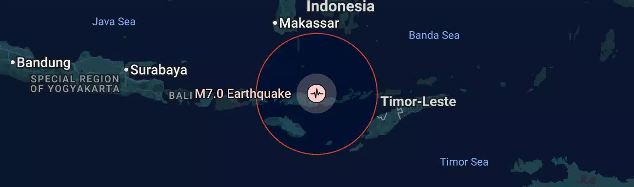
The consecutive magnitude 7.7 (M7.7) earthquakes in Colombia and near Flores Island in eastern Indonesia serve as a stern warning that tectonic stress across the entire Circum-Pacific Belt—popularly known as the Ring of Fire—has reached a critical threshold. Leaving thousands displaced along with severe casualties, these earthquakes are not isolated natural disasters; they prove that energy accumulated at plate boundaries over decades to centuries is transferring to adjacent fault lines like a row of falling dominoes.
Based on the latest crustal deformation data from global research institutions—including the University of Bern in Switzerland, the United States Geological Survey (USGS), and Japan’s Earthquake Research Committee—this analysis provides a multi-dimensional, scientific breakdown of the Top 4 High-Risk Regions most likely to experience the next megathrust earthquake.
1. Tectonic Mechanism Behind the ‘Ring of Fire’ Chain Earthquakes
The Ring of Fire is the most active plate boundary zone on Earth, accounting for roughly 90% of the world’s earthquakes and 81% of its largest seismic events. Spanning approximately 40,000 kilometers, this complex zone consists of subduction zones where the Pacific Plate dives beneath adjacent plates (such as the North American, Eurasian, Indo-Australian, and Nazca plates) alongside transform faults where plates slide horizontally past one another.
Seismologists explain the chain-reaction earthquakes currently observed across the Ring of Fire through two core mechanisms:
- Stress Transfer: When a major earthquake of magnitude 7.0 or higher strikes, the immense energy released during fault rupture does not simply dissipate. Instead, it transfers massive amounts of accumulated stress toward the edges of the ruptured fault, triggering critical stress points in neighboring fault zones and inducing further destruction.
- Critical Stress and Seismic Gaps: Fault lines that have remained silent for decades or centuries despite exceeding their historical recurrence intervals—known as seismic gaps—are in a state of maximized stress accumulation. Even a minor physical shock can cause these faults to rupture instantaneously, carrying an extraordinarily high risk of triggering a megaquake.
2. Top 4 High-Risk Zones for the Next Megaquake (Scientific Evidence)
📌 1) Southern California, USA – San Andreas Fault
- Risk Level: Extremely High (Imminent M7.8+ “Big One”)
- Scientific Basis: The southern segment of the San Andreas Fault (Salton Sea to Wrightwood) lies between the Pacific and North American plates, which move horizontally past each other at a rate of roughly 20 to 37 mm per year. While the average recurrence interval for this section is around 150 years, no major stress release has occurred since the 1857 Fort Tejon earthquake—leaving it locked for over 160 years. According to USGS research, this fault is currently holding its highest level of accumulated strain in over 1,000 years.
- Expected Impact: Major metropolitan areas, including Los Angeles, could experience violent shaking for two minutes or more. This could trigger a complete collapse of essential infrastructure (communications, water, and power) and lead to direct and indirect economic losses estimated at up to $1 trillion.
📌 2) Pacific Northwest, USA / Canada – Cascadia Subduction Zone
- Risk Level: High (M9.0+ Megathrust Risk)
- Scientific Basis: Stretching 1,000 kilometers along the Pacific Northwest coast, the Cascadia Subduction Zone is a convergent boundary where the Juan de Fuca Plate slides beneath the North American Plate. Geological and historical records indicate an average recurrence interval of 300 to 500 years. The last megathrust event occurred in January 1700, meaning the fault has officially entered the statistical window for its next major rupture.
- Expected Impact: A magnitude 9.0+ earthquake could strike major hubs like Seattle, Portland, and Vancouver, triggering massive tsunamis tens of meters high that could devastate coastal cities and infrastructure.
📌 3) Southern Coast of Japan – Nankai Trough
- Risk Level: Very High (M8.0–9.0 Chain Earthquakes)
- Scientific Basis: Located where the Philippine Sea Plate subducts beneath the Eurasian Plate, the Nankai Trough has a well-documented history of generating megathrust earthquakes every 100 to 150 years. According to Japan’s Earthquake Research Committee, the probability of a magnitude 8.0 to 9.0 Nankai Trough earthquake occurring within the next 30 years stands at 70% to 80%.
- Expected Impact: A direct hit on Japan’s core industrial and manufacturing belts—including the Tokyo metropolitan area, Osaka, and Nagoya—would disrupt global supply chains for semiconductor materials, advanced components, and automobiles, sending severe shockwaves through global markets.
📌 4) Andean Subduction Zone, Latin America – Chile & Mexico Coast (Middle America Trench)
- Risk Level: High (Potential for M8.0+ Earthquakes)
- Scientific Basis: Active subduction of the Nazca and Cocos plates has created high plate boundary locking ratios in this region. Following the recent M7.7 earthquake in Colombia, satellite radar interferometry (InSAR) data shows significant stress redistribution along fault lines toward Chile to the south and western Mexico to the north.
- Expected Impact: Powerful tsunamis could sweep across the Pacific coast, while severe damage to mining infrastructure in South America could trigger supply instability in global raw material markets.
3. Disaster Preparedness & Asset Protection Strategies
In an era of escalating natural disasters and climate-related risks, safeguarding personal safety and strategically reallocating assets exposed to geographic vulnerabilities is essential.
🛡️ Disaster Preparedness & Safety Systems
- Structural Retrofitting & Emergency Kits: Inspect homes and workplaces for seismic resilience. Prepare emergency kits containing at least a 72-hour supply of drinking water, non-perishable food, a emergency radio, and portable power banks.
- Emergency Response Drills: Practice the “Drop, Cover, and Hold On” protocol during shaking. Coastal residents should familiarize themselves with immediate evacuation routes to higher ground upon hearing tsunami warnings.
📈 Asset Protection & Portfolio Strategy
- Reduce Exposure to High-Risk Fault Line Assets: Consider trimming equity holdings or exposure to real estate, data centers, and heavy manufacturing infrastructure concentrated in high-risk zones like California and coastal Japan.
- Monitor Disaster Recovery & Infrastructure Stocks: Track global reinsurers (e.g., Swiss Re, Munich Re), emergency satellite communication providers (such as Starlink ecosystem plays), backup power equipment manufacturers (ESS and hydrogen generators), and global engineering and construction firms specializing in disaster recovery, as demand for these sectors surges following catastrophic events.
- Secure Physical Safe-Haven Assets: During a polycrisis—where tectonic disasters intersect with global geopolitical friction—maintaining at least 15% of an investment portfolio in liquid safe-haven assets such as Gold, US Short-Term Treasury Bills (T-Bills), and cash reserves helps protect capital against downside market shocks.